Brandvlei Dam
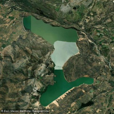
Brandvlei Dam
- Boat Ramps
- 0
- Access Points
- 0
- Species
- 6
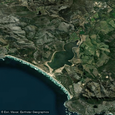
Brandvlei Dam, also known as Lake Marais, is a large reservoir situated approximately 10 km from the town of Worcester in the Western Cape Province of South Africa. Fed by natural hot springs and positioned near the Breede River, the dam sits within the Breede River Catchment — a vast watershed of approximately 12,600 km² flanked by the Franschhoek and Du Toit's Mountains to the west and the Hex River Mountains to the east. Originally a natural wetland (vlei) of about 10 km in extent, the site was developed into a major water storage facility, with the Greater Brandvlei Dam completed in 1981. Today it serves as a critical water supplier for agricultural activities in the Robertson area and beyond, while also offering diverse and productive angling opportunities. The dam is notable for hosting one of the largest known populations of the indigenous Cape whitefish (Barbus andrewi), estimated at well over 100,000 adults, making it a landmark fishery for anglers interested in targeting native South African species alongside a healthy population of introduced sport fish.
Species & education
Learn what type of fish are at Brandvlei Dam and what's needed to catch them.

Find which waters have the species you want to catch

Banded Tilapia
Tilapia sparrmanii
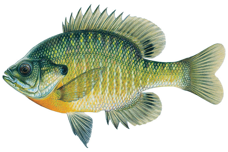
Bluegill Sunfish
Lepomis macrochirus

Common Carp
Cyprinus carpio

Largemouth Bass
Micropterus salmoides

Rainbow Trout
Oncorhynchus mykiss

Smallmouth Bass
Micropterus dolomieu
Fishing spots, boat ramps & amenities
Learn how to get on Brandvlei Dam. Uncover great fishing access points, boat ramps, and all the facilities you need for an unforgettable day on the water. Some locations shown may border or include private property. Always check property boundaries and applicable regulations before visiting. onWater's Public & Private Land layer can help you plan your access with confidence.
Know where you can legally fish on Brandvlei Dam
See public and private land boundaries along the water, turn on private parcels with owner details to know where permission is required, and find land-trust parcels that offer permitted fishing access.
Western Cape licenses and regulations

Western Cape Boating Regulations
National Small Vessel Safety Regulations administered by the South African Maritime Safety Authority (SAMSA), covering recreational boats on inland and coastal waters. National page reused for all provinces, as there is no separate provincial boating-safety authority.

Western Cape Fishing License
Official CapeNature page for the Western Cape freshwater angling licence. A licence is required to fish for freshwater fish in inland public waters (rivers and state dams); apply via the form and supporting documents to CapeNature.

Western Cape Fishing Regulations
CapeNature page covering recreational freshwater fishing rules for dams and rivers in the Western Cape under the Nature Conservation Ordinance, detailing where a licence is required and conditions of use.

Western Cape Stream Access Laws
South Africa's National Water Act (No. 36 of 1998) is the national law governing rights to and use of rivers and watercourses - the framework relevant to stream/water access. National page reused as no distinct provincial stream-access page exists.
Take Brandvlei Dam with you
The onWater Fish app keeps this water's access points, species and conditions in your pocket, with the tools you use once you're there.
Use the map without signal
Download the map around Brandvlei Dam to use it offline when coverage drops.
Log your catches here
Keep a private fishing journal for Brandvlei Dam to find where and when fish are biting for you.
HD depth charts from Garmin
Find drop offs, ledges, channels, points and shallow flats with Garmin depth charts in the app.
Get the onWater Fish app
Free on iOS and Android
Water and weather conditions (10 day forecast)
See the best times to fish Brandvlei Dam and check the forecast before you go.
Canal From Brandvlei Dam Basin @ Die Nekkies
All Flow Stations
Fishing near Brandvlei Dam
Explore Western Cape waters
Top fishing waters
No waters available right now.
Popular Cities
Loading popular cities...
Explore near Brandvlei Dam
Fishing spots
More in Western Cape

Smarter Fishing Starts in the App.
onWater Fish gives you everything you need to plan smarter, fish better, and own every trip from first cast to last.