East Arm
- Saltwater
- Bay
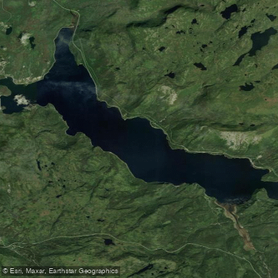
East Arm
- Saltwater
- Bay
- Sq. miles
- 10
- Boat Ramps
- 0
- Access Points
- 0
- Species
- 3
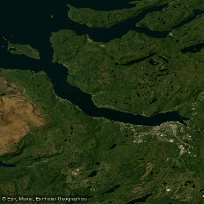
East Arm is a significant, deep-water fjord forming the inner basin of Bonne Bay on Newfoundland's west coast. This saltwater environment is characterized by dramatic depths, with a maximum recorded depth of 230 meters in the East Arm basin, and is separated from the outer bay by a shallow sill near Norris Point with a channel depth of 26 meters. The bay receives freshwater input from several rivers, most notably the Lomond Main River, which flows directly into the East Arm. The nearshore zones feature a mix of bottom substrates, slopes, and vegetation, creating diverse habitats. The area is managed as part of Salmon Fishing Area 14A and is noted for its cold-temperate marine ecosystem.
Species & education
Learn what type of fish are at East Arm and what's needed to catch them.

Find which waters have the species you want to catch

Atlantic Salmon
Salmo salar

Brook Trout
Salvelinus fontinalis

Winter Flounder
Pseudopleuronectes americanus
Fishing spots, boat ramps & amenities
Learn how to get on East Arm. Uncover great fishing access points, boat ramps, and all the facilities you need for an unforgettable day on the water. Some locations shown may border or include private property. Always check property boundaries and applicable regulations before visiting. onWater's Public & Private Land layer can help you plan your access with confidence.
Productive areas include the nearshore zones with mixed bottom types—gravel, sand, and vegetation—which provide habitat for forage and predator species. The confluence area where the Lomond Main River empties into the East Arm can be productive, especially on an outgoing tide. The deep central channel of the East Arm, particularly along its edges and drop-offs, is a target for boat-based anglers. The sill area near Norris Point, with its strong currents and depth change, can concentrate fish.
Know where you can legally fish on East Arm
See public and private land boundaries along the water, turn on private parcels with owner details to know where permission is required, and find land-trust parcels that offer permitted fishing access.
Nl licenses and regulations
No licenses or regulations available for Nl.
Take East Arm with you
The onWater Fish app keeps this water's access points, species and conditions in your pocket, with the tools you use once you're there.
Use the map without signal
Download the map around East Arm to use it offline when coverage drops.
Log your catches here
Keep a private fishing journal for East Arm to find where and when fish are biting for you.
Get the onWater Fish app
Free on iOS and Android
Tides, wind & water conditions (10 day forecast)
On open water, wind and tide matter as much as the weather. See the best times to fish East Arm and check the marine forecast before you launch.
Loading tide predictions…
Fishing near East Arm
Explore Nl waters
Top fishing waters
No waters available right now.
Popular Cities
Loading popular cities...
Explore near East Arm

Smarter Fishing Starts in the App.
onWater Fish gives you everything you need to plan smarter, fish better, and own every trip from first cast to last.