Killala Bay
- Saltwater
- Bay
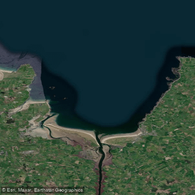
Killala Bay
- Saltwater
- Bay
- Sq. miles
- 31
- Boat Ramps
- 0
- Access Points
- 0
- Species
- 23
Killala Bay is a premier saltwater fishing destination on Ireland's west coast, forming a broad estuary for the River Moy where it meets the Atlantic Ocean. The bay's defining characteristic is the remarkably close proximity of the deep waters of the continental shelf to the shoreline, creating a fertile marine environment that supports an exceptional variety of species, from common inshore fish to unusual deep-water specimens. This unique geography, with a maximum depth of 36 metres (20 fathoms) and a width of about 5.5 miles, provides sheltered conditions for boat angling while also offering extensive rock marks and beach fishing opportunities along its shores. The bay is a designated Ramsar site (Killala Bay/Moy Estuary), recognized for its ecological importance, and serves as a hub for both serious competition anglers and recreational fishermen seeking a diverse and productive experience.
Species & education
Learn what type of fish are at Killala Bay and what's needed to catch them.

Find which waters have the species you want to catch

Angler
Lophius piscatorius

Atlantic Cod
Gadus morhua

Atlantic Salmon
Salmo salar

Ballan Wrasse
Labrus bergylta

Blue Shark
Prionace glauca

Coalfish
Pollachius virens

Conger Eel
Conger conger

Cuckoo Wrasse
Labrus mixtus

European Flounder
Platichthys flesus

European Plaice
Pleuronectes platessa

Goldsinny Wrasse
Ctenolabrus rupestris

John Dory
Zeus faber

Lemon Sole
Microstomus kitt

Lesser Spotted Dogfish
Scyliorhinus canicula

Ling
Molva molva

Pollack
Pollachius pollachius

Poor Cod
Trisopterus minutus

Pouting
Trisopterus luscus

Sea Trout
Salmo trutta

Small-eyed Ray
Raja microocellata

Thresher Shark
Alopias vulpinus

Tope
Galeorhinus galeus

Turbot
Scophthalmus maximus
Fishing spots, boat ramps & amenities
Learn how to get on Killala Bay. Uncover great fishing access points, boat ramps, and all the facilities you need for an unforgettable day on the water. Some locations shown may border or include private property. Always check property boundaries and applicable regulations before visiting. onWater's Public & Private Land layer can help you plan your access with confidence.

M/V Shingle
Know where you can legally fish on Killala Bay
See public and private land boundaries along the water, turn on private parcels with owner details to know where permission is required, and find land-trust parcels that offer permitted fishing access.
Co. Mayo licenses and regulations
No licenses or regulations available for Co. Mayo.
Take Killala Bay with you
The onWater Fish app keeps this water's access points, species and conditions in your pocket, with the tools you use once you're there.
Use the map without signal
Download the map around Killala Bay to use it offline when coverage drops.
Log your catches here
Keep a private fishing journal for Killala Bay to find where and when fish are biting for you.
Get the onWater Fish app
Free on iOS and Android
Tides, wind & water conditions (10 day forecast)
On open water, wind and tide matter as much as the weather. See the best times to fish Killala Bay and check the marine forecast before you launch.
Loading tide predictions…
Fishing near Killala Bay
Finned 35
Deel [Crossmolina]
Donegal Bay Southern
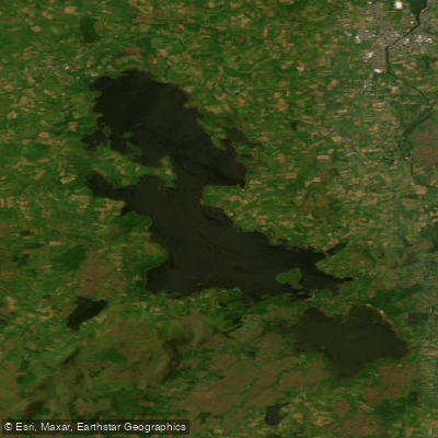
Lough Conn
Leaffony 34
Castlebar
Easky
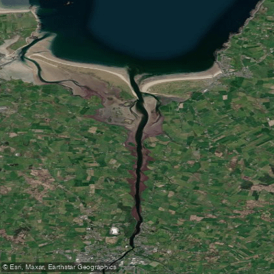
Moy Estuary

Suck
Explore Mayo waters
Top fishing waters
No waters available right now.
Popular Cities
Loading popular cities...
Explore near Killala Bay
Fish species
Nearby waters
More in Co. Mayo

Smarter Fishing Starts in the App.
onWater Fish gives you everything you need to plan smarter, fish better, and own every trip from first cast to last.