Loddon Staithe
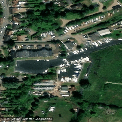
Loddon Staithe
Loddon Staithe sits on the River Chet in the South Norfolk town of Loddon, marking the point where the river becomes navigable. From here the Chet flows roughly 3½ miles eastward before joining the River Yare near Reedham.
The staithe serves as a natural hub for both waterborne and land-based visitors. Public moorings on both banks welcome boats arriving along the Chet, and the site offers views downstream toward Pyes Mill.
It is a recognised gathering spot for fishermen and walkers, including those following the Wherryman's Way long-distance trail. A car park adjoins the staithe, and the area is also the starting point for accessible walking routes along the river.
The historic 18th-century Loddon Watermill stands close by, adding to the character of this riverside setting.
Nearby points of interest
Find excellent fishing spots, easy access to boat ramps, and all the amenities you need for a memorable day. Your adventure starts here.
Water and weather conditions (10 day forecast)
Check the forecast at Loddon Staithe before you go fishing.
No forecast data available.
Fishing near Loddon Staithe
River Thames
New River
THAMES MIDDLE
River Lea
River Brent
THAMES LOWER
River Roding
River Mole
MEDWAY
Pymme's Brook
England licenses and regulations
Explore England waters
Top fishing waters
No waters available right now.
Popular Cities
Loading popular cities...
Explore near Loddon Staithe
Nearby spots
Nearby waters
More in England

Smarter Fishing Starts in the App.
onWater Fish gives you everything you need to plan smarter, fish better, and own every trip from first cast to last.