Bedeque Bay
- Saltwater
- Bay
Bedeque Bay
- Saltwater
- Bay
- Sq. miles
- 28
- Boat Ramps
- 0
- Access Points
- 0
- Species
- 3
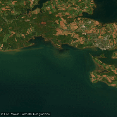
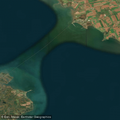
Bedeque Bay is a significant estuary on the southern coast of Prince Edward Island, forming a broad, sheltered inlet that receives the freshwater flows of the Dunk and Wilmot Rivers. The eastern half of the bay, along with the mouths of these rivers, comprises the Bedeque region, which is protected from the open Northumberland Strait by Hurd’s Point. This area is ecologically notable as one of the few remaining wild oyster-holding estuaries in North America and the only such estuary in Canada. The bay features a mix of soft mud and sandier sediments across its bottom, with a salinity gradient that increases from the upper estuary near the river mouths to the lower, more marine-influenced areas near the Strait. For generations, this bay has been the principal source for Prince Edward Island's wild oyster fishery, a cornerstone of both the local economy and cultural heritage, though it now faces severe ecological challenges.
Species & education
Learn what type of fish are at Bedeque Bay and what's needed to catch them.

Find which waters have the species you want to catch

Atlantic Tomcod
Microgadus tomcod

Rainbow Smelt
Osmerus mordax

Winter Flounder
Pseudopleuronectes americanus
Fishing spots, boat ramps & amenities
Learn how to get on Bedeque Bay. Uncover great fishing access points, boat ramps, and all the facilities you need for an unforgettable day on the water. Some locations shown may border or include private property. Always check property boundaries and applicable regulations before visiting. onWater's Public & Private Land layer can help you plan your access with confidence.
The entire Bedeque region, particularly the eastern half of the bay and the mouths of the Dunk and Wilmot Rivers, has been the heart of the wild oyster fishery. Specific productive areas include the Dunk River Public Fishing Area within the bay. Hurd’s Point provides a natural breakwater, creating calmer conditions in its lee. The bottom structure varies, with areas of hard substrate being critical for oyster settlement and growth. Salutation Cove, within the Bedeque region, contains traditional bottom leases used by aquaculture operations.
Know where you can legally fish on Bedeque Bay
See public and private land boundaries along the water, turn on private parcels with owner details to know where permission is required, and find land-trust parcels that offer permitted fishing access.
Pe licenses and regulations
No licenses or regulations available for Pe.
Take Bedeque Bay with you
The onWater Fish app keeps this water's access points, species and conditions in your pocket, with the tools you use once you're there.
Use the map without signal
Download the map around Bedeque Bay to use it offline when coverage drops.
Log your catches here
Keep a private fishing journal for Bedeque Bay to find where and when fish are biting for you.
Get the onWater Fish app
Free on iOS and Android
Tides, wind & water conditions (10 day forecast)
On open water, wind and tide matter as much as the weather. See the best times to fish Bedeque Bay and check the marine forecast before you launch.
Loading tide predictions…
Explore Pe waters
Top fishing waters
No waters available right now.
Popular Cities
Loading popular cities...
Explore near Bedeque Bay

Smarter Fishing Starts in the App.
onWater Fish gives you everything you need to plan smarter, fish better, and own every trip from first cast to last.