Tatamagouche Bay
- Saltwater
- Bay
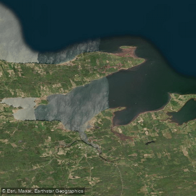
Tatamagouche Bay
- Saltwater
- Bay
- Sq. miles
- 16
- Boat Ramps
- 0
- Access Points
- 0
- Species
- 5
Tatamagouche Bay is a picturesque and protected tidal bay on the Northumberland Strait in northern Nova Scotia. Its name, derived from the Mi'kmaq word for "meeting of the waters," reflects its formation at the confluence of the French and Waugh Rivers. This creates a unique environment that is part river and part lake, with waters noted for being among the warmest in Atlantic Canada. The bay's shoreline is characterized by a mix of marshland, gentle beaches, and the charming seaside village of Tatamagouche. The area is also a significant center for aquaculture, with several large shellfish leases operating within its waters.
Species & education
Learn what type of fish are at Tatamagouche Bay and what's needed to catch them.

Find which waters have the species you want to catch

Atlantic Salmon
Salmo salar

Brook Trout
Salvelinus fontinalis

Haddock
Melanogrammus aeglefinus
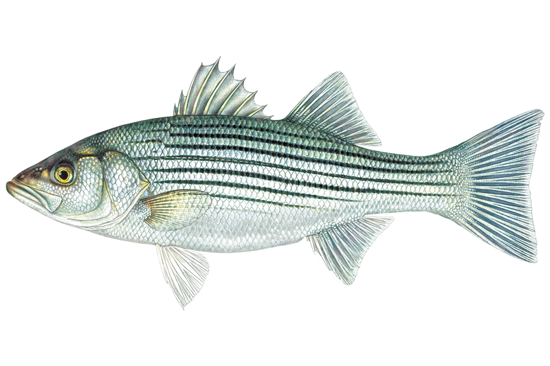
Striped Bass
Morone saxatilis

Winter Flounder
Pseudopleuronectes americanus
Fishing spots, boat ramps & amenities
Learn how to get on Tatamagouche Bay. Uncover great fishing access points, boat ramps, and all the facilities you need for an unforgettable day on the water. Some locations shown may border or include private property. Always check property boundaries and applicable regulations before visiting. onWater's Public & Private Land layer can help you plan your access with confidence.
Productive areas are often found where structure and current create ambush points. The mouths of the French and Waugh Rivers, where freshwater meets salt, are natural focal points for migrating fish like salmon. The extensive shellfish aquaculture leases, which cover hundreds of hectares across the bay, also serve as significant underwater structure. These leased areas, marked by surface floats, attract bait and predators but are private property for aquaculture operations and must not be interfered with.
Know where you can legally fish on Tatamagouche Bay
See public and private land boundaries along the water, turn on private parcels with owner details to know where permission is required, and find land-trust parcels that offer permitted fishing access.
Ns licenses and regulations

Nova Scotia Boating Regulations
This page explains what a Pleasure Craft License is, who needs one, how to apply for one, and how to keep your information up to date.

Nova Scotia Fishing License
Official Government of Nova Scotia page to learn about and buy a recreational sportfishing (General Fishing) licence — who needs one, licence types (seasonal and 1-day), fees, and how to apply online or through vendors.

Nova Scotia Fishing Regulations
Nova Scotia's official recreational sportfishing laws and regulations, linking the current Anglers' Handbook and the Maritime Provinces Fishery Regulations covering seasons, bag and size limits, gear rules, and where you can fish.
Take Tatamagouche Bay with you
The onWater Fish app keeps this water's access points, species and conditions in your pocket, with the tools you use once you're there.
Use the map without signal
Download the map around Tatamagouche Bay to use it offline when coverage drops.
Log your catches here
Keep a private fishing journal for Tatamagouche Bay to find where and when fish are biting for you.
Get the onWater Fish app
Free on iOS and Android
Tides, wind & water conditions (10 day forecast)
On open water, wind and tide matter as much as the weather. See the best times to fish Tatamagouche Bay and check the marine forecast before you launch.
Loading tide predictions…
Fishing near Tatamagouche Bay
Explore Ns waters
Top fishing waters
No waters available right now.
Popular Cities
Loading popular cities...
Explore near Tatamagouche Bay

Smarter Fishing Starts in the App.
onWater Fish gives you everything you need to plan smarter, fish better, and own every trip from first cast to last.