Porters Lake
Porters Lake
- Boat Ramps
- 0
- Access Points
- 0
- Species
- 0
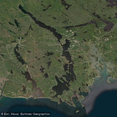
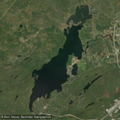
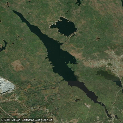
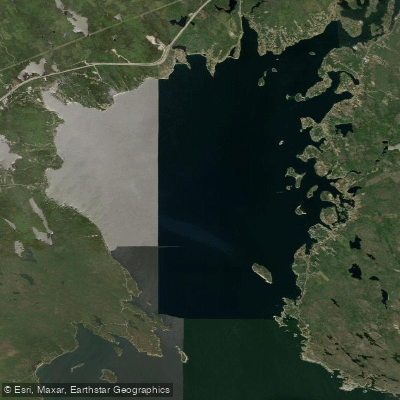
Porters Lake is a striking glacial lake located in Halifax County, Nova Scotia, Canada, situated in the Eastern Shore region approximately 27.8 km from Halifax. Crescent-shaped and stretching roughly 24 km in length and up to 1 km wide, it is one of the most popular recreational lakes in the region. What makes Porters Lake particularly unique among Nova Scotia's lakes is its tidal connection — fed by East Brook and West Brook at its northern end and draining to the Atlantic Ocean near Lawrencetown Beach via Rocky Run, the lake transitions from nearly fresh water at the north end to nearly full saltwater at the south end. This salinity gradient creates a diverse and dynamic aquatic environment that supports a variety of fish species. The lake reaches a maximum depth of 30 metres (98 ft), with the north end averaging around 12 metres deep and the south end averaging approximately 5 metres deep. Several small islands dot the southern portion of the lake, adding structural complexity that attracts fish.
Species & education
Learn what type of fish are at Porters Lake and what's needed to catch them.
No species information available.
Fishing spots, boat ramps & amenities
Learn how to get on Porters Lake. Uncover great fishing access points, boat ramps, and all the facilities you need for an unforgettable day on the water. Some locations shown may border or include private property. Always check property boundaries and applicable regulations before visiting. onWater's Public & Private Land layer can help you plan your access with confidence.
- Small Islands in the Southern Section: These islands create excellent structure — rocky shorelines, current breaks, and depth changes — making them prime targets for smallmouth bass and white perch.
- Northern Inflows (East Brook and West Brook): The freshwater inflow areas at the north end of the lake are natural gathering points for brook trout, especially during spring and fall.
- Depth Transitions: The dramatic depth change from the shallow south end (5 m average) to the deep north end (12 m average, with a 30 m maximum) creates thermoclines and structural edges that concentrate fish, particularly smallmouth bass in summer.
- Canal Area: The man-made canal connecting to the Atlantic near Rocky Run offers a unique transitional fishing environment worth exploring by canoe or kayak.
Know where you can legally fish on Porters Lake
See public and private land boundaries along the water, turn on private parcels with owner details to know where permission is required, and find land-trust parcels that offer permitted fishing access.
Ns licenses and regulations

Nova Scotia Boating Regulations
This page explains what a Pleasure Craft License is, who needs one, how to apply for one, and how to keep your information up to date.

Nova Scotia Fishing License
Official Government of Nova Scotia page to learn about and buy a recreational sportfishing (General Fishing) licence — who needs one, licence types (seasonal and 1-day), fees, and how to apply online or through vendors.

Nova Scotia Fishing Regulations
Nova Scotia's official recreational sportfishing laws and regulations, linking the current Anglers' Handbook and the Maritime Provinces Fishery Regulations covering seasons, bag and size limits, gear rules, and where you can fish.
Take Porters Lake with you
The onWater Fish app keeps this water's access points, species and conditions in your pocket, with the tools you use once you're there.
Use the map without signal
Download the map around Porters Lake to use it offline when coverage drops.
Log your catches here
Keep a private fishing journal for Porters Lake to find where and when fish are biting for you.
HD depth charts from Garmin
Find drop offs, ledges, channels, points and shallow flats with Garmin depth charts in the app.
Get the onWater Fish app
Free on iOS and Android
Water and weather conditions (10 day forecast)
See the best times to fish Porters Lake and check the forecast before you go.
No forecast data available.
Fishing near Porters Lake
Explore Ns waters
Top fishing waters
No waters available right now.
Popular Cities
Loading popular cities...
Explore near Porters Lake

Smarter Fishing Starts in the App.
onWater Fish gives you everything you need to plan smarter, fish better, and own every trip from first cast to last.