Río Longaví
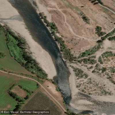
Río Longaví
- Boat Ramps
- 0
- Access Points
- 0
- Species
- 0
Río Longaví is a 120-kilometer river flowing through the Maule Region of south-central Chile, originating in the Andes at approximately 2,000 meters above sea level and draining westward across the Central Valley before joining the Perquilauquén River to form the Loncomilla River. The river's name derives from the Mapudungun language, meaning "snake's head," a fitting description for a waterway that winds through diverse terrain from high Andean headwaters down through agricultural lowlands. The sub-basin covers roughly 965.5 square kilometers and is shaped by the Longaví River and its tributaries, most notably the Blanco River, which drains the southeastern slopes of the Nevado de Longaví — a snow-covered extinct volcano rising to 3,230 meters and one of the defining landmarks of Linares Province. The upper watershed is defined by the presence of the Bullileo and Digua dams, which influence flow regimes in the upper reaches of the system. The river passes near the town of Longaví as it moves generally northwestward through the Central Valley, a region that accounts for a significant portion of Chile's agricultural production and exports.
Species & education
Learn what type of fish are at Río Longaví and what's needed to catch them.
No species information available.
Fishing spots, boat ramps & amenities
Learn how to get on Río Longaví. Uncover great fishing access points, boat ramps, and all the facilities you need for an unforgettable day on the water. Some locations shown may border or include private property. Always check property boundaries and applicable regulations before visiting. onWater's Public & Private Land layer can help you plan your access with confidence.
Know where you can legally fish on Río Longaví
See public and private land boundaries along the water, turn on private parcels with owner details to know where permission is required, and find land-trust parcels that offer permitted fishing access.
Maule licenses and regulations
No licenses or regulations available for Maule.
Take Río Longaví with you
The onWater Fish app keeps this water's access points, species and conditions in your pocket, with the tools you use once you're there.
Use the map without signal
Download the map around Río Longaví to use it offline when coverage drops.
Log your catches here
Keep a private fishing journal for Río Longaví to find where and when fish are biting for you.
Get the onWater Fish app
Free on iOS and Android
Water and weather conditions (10 day forecast)
See the best times to fish Río Longaví and check the forecast before you go.
Rio Longavi En La Quiriquina
All Flow Stations
Fishing near Río Longaví
Explore Maule waters
Top fishing waters
No waters available right now.
Popular Cities
Loading popular cities...
Explore near Río Longaví

Smarter Fishing Starts in the App.
onWater Fish gives you everything you need to plan smarter, fish better, and own every trip from first cast to last.